[
Date Prev][
Date Next][
Thread Prev][
Thread Next][
Date Index][
Thread Index]
[
List Home]
|
Re: [sumo-user] Time-location diagram in Ring road scenario
|
Hi Saeed,
1. Angle from the FCD file (floating car data) can be converted to distance.
2. You can also use TraCI getDistance as well.
Hi All,
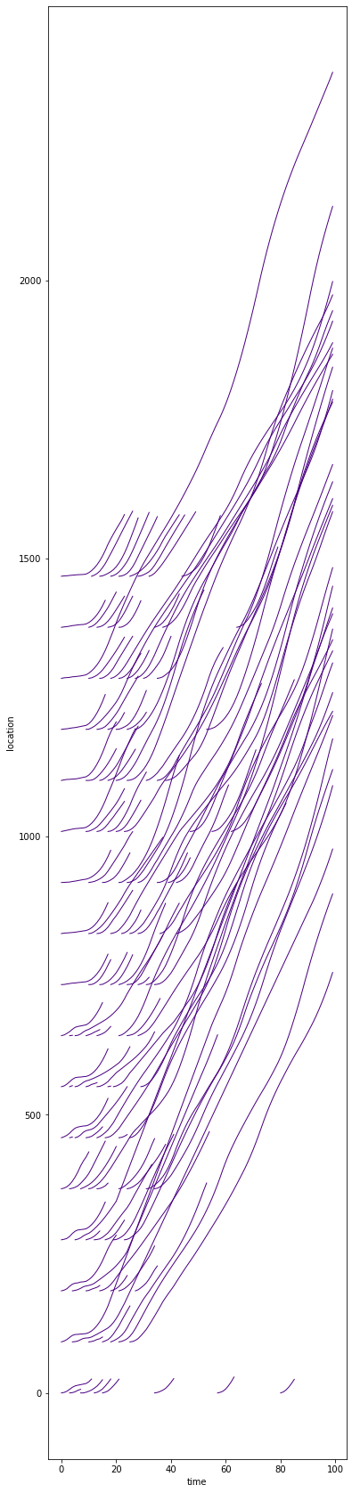
I have a ring road scenario, which is built by 85 edges (relatively similar size). I try to plot a time-location diagram. The cars start from different parts of the ring. I have x, y, and pos (position is a given edge with some miscaluclations). x and y are not accurate measures, because my ring's diameter is 497m, but x and y estimate the diameter as 560m. I do not know why x and y are not much accurate.
I tried to define the distance between starting locations, and add speed in each second to calculate relative location (i.e., x(t) = x(t-1) + v(t)*1). But, this approach shows a lot of crashes (see the below picture), which is not correct.
I highly appreciate any help or idea.
_______________________________________________
sumo-user mailing list
sumo-user@xxxxxxxxxxx
To unsubscribe from this list, visit https://www.eclipse.org/mailman/listinfo/sumo-user