Hello everyone, Hello Jakob
I have a question about the generation of a highway entry in SUMO, by using an opendrive-file as input.
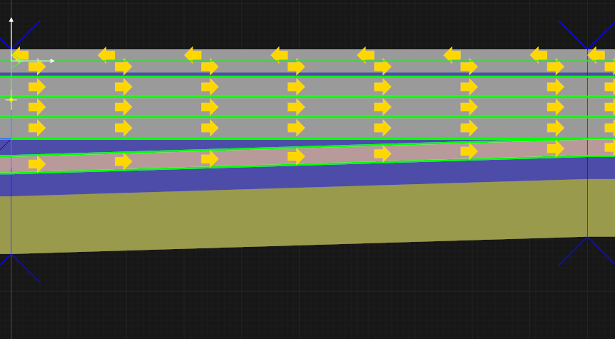
As you can see in the picture “highway in SCANeR”. We have at the Highway Entry a Lane with different width along the distance.
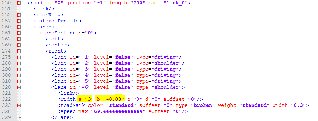
This kind of behavior is also described in the Opendrive File which is used as Input. (See Pictures “short part ord.PNG and Modell_Highway.xodr”).
In an Opendrive File description I toke also this short part of text:
The actual width at a given point is computed with a polynomial function of third order. It looks like:
width = a + b*ds + c*ds2
+ d*ds3
with
width
being the width at a given position
a, b, c, d
being the coefficients and
ds
being the distance along the reference line between the start of the entry and the actual position.
As you can see we have on the picture
short part ord.PNG the parameter “a” and also “b” are defined with a non-zeros value (road id=0 and lane id -6). That lane represents the ramp of the highway exit.
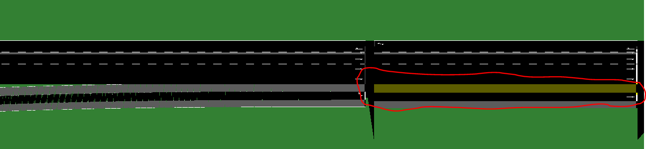
My question is to know, why Sumo generate that highway with a constant value of the ramp of highway exit, as you can see in the Picture “Highway SUMO”.
I don’t now, if we have a bug by the generation of highway with opendrive file or maybe I forgot to add a very important parameter by the generation of the highway by using
a Opendrive File?
Because it is intended that the lane should have a decreasing lane width along the distance (ramp on).
In general I note that the lane would be always maintain constant although in the opendrive file the coefficient “b”, ”c” or “d” are non zeros coefficient.
I would be very happy to read you very soon!
Thank you
Christian