Hi Diethard,
I had a little time to fix the issue. The PR should be merged into
master soon; it is up here if you want to build it yourself:
https://github.com/locationtech/geomesa/pull/1512
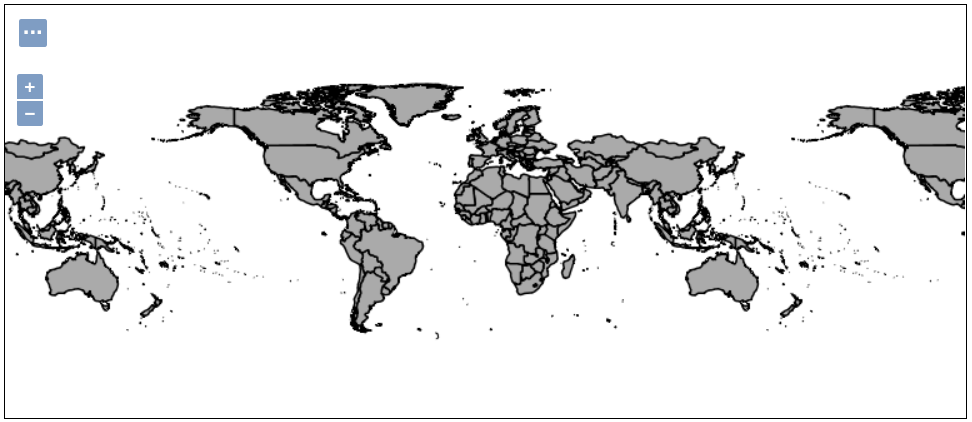
I tested it out with your shapefile, and it ingested 244 and failed
to ingest 4 of the features. Hopefully that will be good enough for
now...

Thanks,
Emilio
On 05/17/2017 10:46 AM, Emilio
Lahr-Vivaz wrote:
That would be awesome, thanks!
On 05/17/2017 10:41 AM, Diethard
Steiner wrote:
Ok, thanks for clarifying. I wait for your commit next week
then. Please let me know when ready ... I am also preparing a
blog post/tutorial on this, so this can be beneficial for more
users.
Probably the tutorial was originally written under an
earlier indexing scheme. We used to be more lenient in how
we indexed values - we would treat values greater than 180
as 180. However, this lead to some users having unexpected
results, so we decided to fail early.
Thanks,
Emilio
On 05/17/2017 10:07 AM,
Diethard Steiner wrote:
Hi Emilio,
Thanks a lot for your reply! It would be great if you
could look into this next week.
Since this shapefile is reference in the GeoMesa
Spark Jupyter tutorial, I am a bit surprised ingestion
doesn't work. Maybe the reason for this is that I am
using the simplified shapefile as opposed to the normal
one. I will try the latter one as soon as I find time
and report back.
I also tried to open the simplified shapefile in QGIS
and it was displayed just fine.
Best regards,
Diethard
Hi Diethard,
From the exception, it looks like there are some
polygons in the shapefile that are outside the lat/lon
bounds of [-90, 90] and [-180, 180]. When we encounter
coordinates like that we fail the indexing as invalid.
It's also possible that there are some subtle
precision errors going on, since the coordinates are
very close to 180. I'm not sure if that would be
coming from the shapefile or something in our
processing.
I think for a quick fix, in our shapefile ingestion
code we should be ingesting the features one at a
time, instead of all at once. This would allow us to
skip any polygons that have invalid coordinates, but
still ingest the rest of the shapefile:
https://github.com/locationtech/geomesa/blob/master/geomesa-utils/src/main/scala/org/locationtech/geomesa/utils/geotools/GeneralShapefileIngest.scala#L91
As an example, in our non-shapefile ingest code we
ingest features one at a time:
https://github.com/locationtech/geomesa/blob/master/geomesa-tools/src/main/scala/org/locationtech/geomesa/tools/ingest/AbstractIngest.scala#L125-L138
I don't think I have time to look into it this week,
but verifying the CRS and coordinates in the shapefile
would also be a good idea. I should have time next
week if it's not resolved by then.
Thanks,
Emilio
On 05/16/2017 06:23 PM,
Diethard Steiner wrote:
Thanks a lot Jim and Emilio for your
replies!
I quickly tried without specifying the
feature/schema:
geomesa ingest -u root -p password \
-c myNamespace.countries -f shapeFile
TM_WORLD_BORDERS_SIMPL-0.3.shp
And I get following error:
ERROR requirement failed: Values out of bounds
([-180.0 180.0] [-90.0 90.0]): [-180.0
180.00000190734863] [-90.0 -60.54722595214844]
java.lang.IllegalArgumentException: requirement
failed: Values out of bounds ([-180.0 180.0]
[-90.0 90.0]): [-180.0 180.00000190734863]
[-90.0 -60.54722595214844]
at scala.Predef$.require(Predef.scala:219)
at org.locationtech.geomesa.curve.XZ2SFC.org$locationtech$geomesa$curve$XZ2SFC$$normalize(XZ2SFC.scala:321)
at
org.locationtech.geomesa.curve.XZ2SFC.index(XZ2SFC.scala:55)
at
org.locationtech.geomesa.index.index.XZ2Index$$anonfun$toIndexKey$1.apply(XZ2Index.scala:124)
It's quite late over here now ... so I'll
only have a chance to check your reply tomorrow.
Thanks in advance for your help!
Best regards,
Diethard
_______________________________________________
geomesa-users mailing list
geomesa-users@xxxxxxxxxxxxxxxx
To change your delivery options, retrieve your password, or unsubscribe from this list, visit
https://dev.locationtech.org/mailman/listinfo/geomesa-users
_______________________________________________
geomesa-users mailing list
geomesa-users@xxxxxxxxxxxxxxxx
To change your delivery options, retrieve your password, or unsubscribe from this list, visit
https://dev.locationtech.org/mailman/listinfo/geomesa-users
_______________________________________________
geomesa-users mailing list
geomesa-users@xxxxxxxxxxxxxxxx
To change your delivery options, retrieve your password, or unsubscribe from this list, visit
https://dev.locationtech.org/mailman/listinfo/geomesa-users
_______________________________________________
geomesa-users mailing list
geomesa-users@xxxxxxxxxxxxxxxx
To change your delivery options, retrieve your password, or unsubscribe from this list, visit
https://dev.locationtech.org/mailman/listinfo/geomesa-users
|

